|
Since the 02/12/2003 Progress Report, a lot of work
has been accomplished in Shenandoah Country, resulting in a couple of new items
being added to the list of
mileposts on the Shenandoah Division. Chuck, Jan, and Rich have been
giving me assistance with stabilizing the New Castle peninsula that I'm reusing
from the V1 layout. We have placed footers under each of the leg sets and added
vertical stiffeners to the footers. We added additional cross-braces across the
legs to help solidify this peninsula. These braces weren't necessary on the V1
layout because this peninsula was anchored to the wall at one end, but it is
somewhat freestanding in the middle of the V2 layout. We have also secured all
the New Castle peninsula footers to the floor, and we attached the New Castle
peninsula to the "new" benchwork and installed the fascia support at Broad Run.
We have also worked on aligning the rail joints on the Sandy Ridge/Craig
Creek/Laurel side of the New Castle peninsula.
I have installed the subroadbed behind the backdrop for the James River paper
mill at Catawba. I also laid all of the Vinylbed for the James River spurs.
In Catawba, I laid track to finish the Catawba Propane/Alleghany Building Supply
spurs along with installing the Valley Feed spur and the turnouts and track for
the James River Lead. Moving to Abbott, the Craig Creek Chip Co. and Martin
Marietta spurs and turnouts have been laid.
I have spent some time updating the layout plan in 3rd PlanIt. I added Knob
Creek in Catawba, and I've done some extensive redesign of the Covington and
Carpenter areas, along with some minor changes at Ridgemont and High Meadow. I
updated the web site with all of the lower level layout design changes,
including the town and industry changes. Be sure to check the
What's New page as I'll post a notice when the
upper level changes are added to the web site.
With the upper level design work completed, I printed all of the 3rd PlanIt
templates from Laurel to Pearson Curve. I then started assembling templates in
preparation for cutting subroadbed. I finished cutting the subroadbed from
Laurel to north of Shenandoah Junction, and I've cut risers for this subroadbed
along with the NS CR&E Division Charleston, W. Va. staging yard.
Larry also came over for a Saturday work session. He and I cut the subroadbed
for the NS CR&E Division Charleston, W. Va. staging yard. We installed the
risers and subroadbed at Broad Run to tie the "new" benchwork to the "old,"
resulting in a milepost being accomplished. We also
installed the fascia support board at Laurel. We then installed risers and
subroadbed from Laurel to the curve just south of Shenandoah Junction, Va.,
resulting in yet another major milepost.
The pictures below show the bulk of the progress that has been made on the
Shenandoah Division since the last report.
|
|
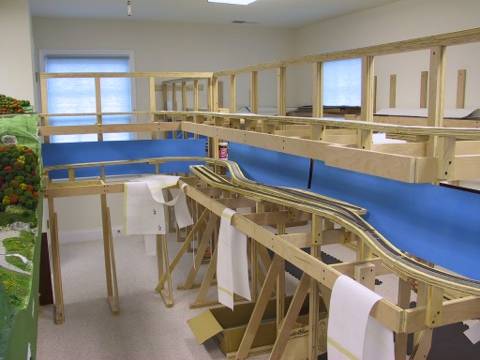
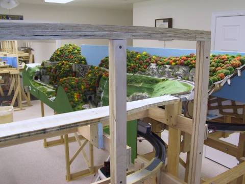
Progress as of March 16, 2003 |
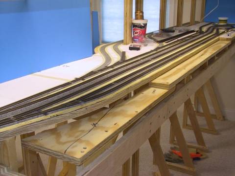
Overall view of Catawba showing the completed James River Lead and
Vinylbed installed for the three James River Paper Co. spurs that will
curve behind the backdrop.
|
Close-up view at Catawba showing the Valley Feed spur.
|
The Alleghany Building Supply spur is in the foreground near the south
end of Catawba, Va.
|
Another overall view of Catawba showing the James River Lead in the
background.
|
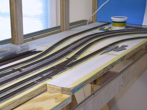
Benchwork and Vinylbed has been installed for the James River spurs
that will be behind the backdrop at Catawba.
|
Another view of the James River spurs; total capacity at James River is
approximately 40-45 cars.
|
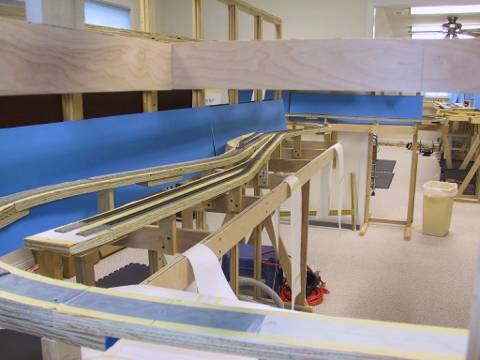
Overall view of Abbott. The Martin Marietta (Abbott Quarry) spurs are
on the short branch in the foreground, while the Craig Creek Chip Co. spur
comes off the mainline in the background.
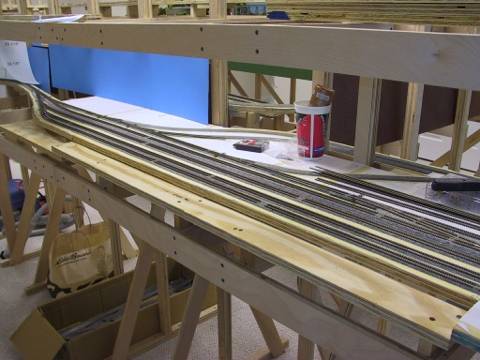
|
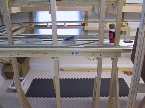
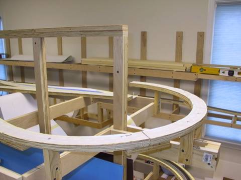
This photo shows the last piece of subroadbed to be installed on the
lower level mainline between just north of Abbott, Va. over Broad Run.
This piece of subroadbed links the "new" Catawba peninsula with the "old"
New Castle peninsula that is being reused from the V1 layout.
|
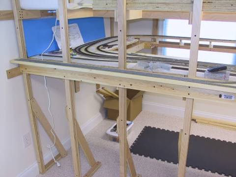
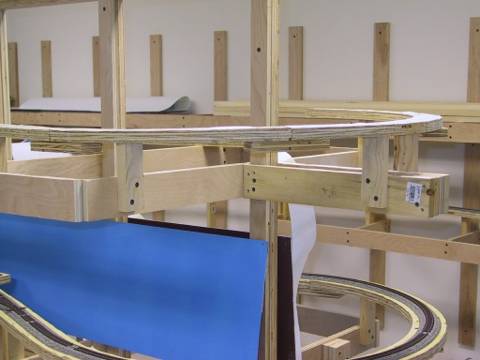
Overall view of the aisle between Abbott and New Castle, showing newly installed subroadbed at the
north end of Abbott in the Broad Run area.
|
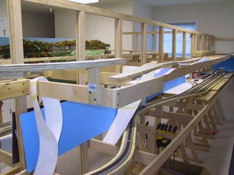
Another view of Abbott. This view will not be possible once the
backdrop is installed. The last piece of lower level mainline subroadbed
is in the foreground.
|
Another view of the Broad Run area from behind the future backdrop
looking into Broad Run Tunnel.
|
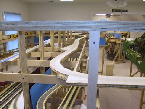
Another overall view of Abbott on the lower level. Chimney Rock Tunnel
will be in the foreground; James River spurs at Catawba are to the left.
|
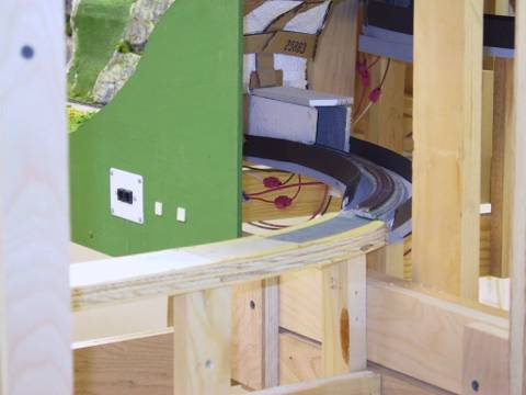
Another view of the Chimney Rock area at the north end of Abbott.
|
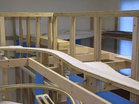
Overall view of the Laurel, Va. area at the end of the aisle. Dixie
Plastic & Forming will be located straight ahead behind the mainline.
|
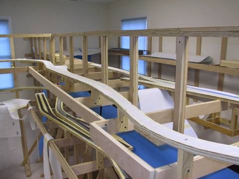
Another view of Laurel showing the future location of the Appalachian
Power Company's Laurel Plant.
|
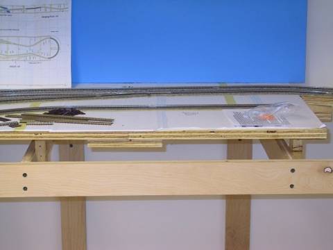
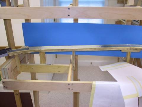
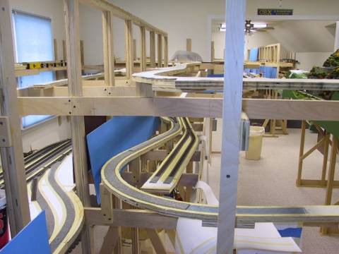
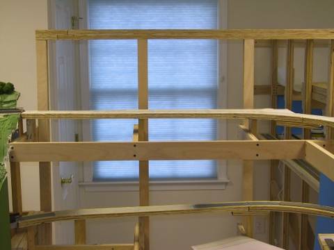
Overall view of the north end of the Laurel passing siding.
|
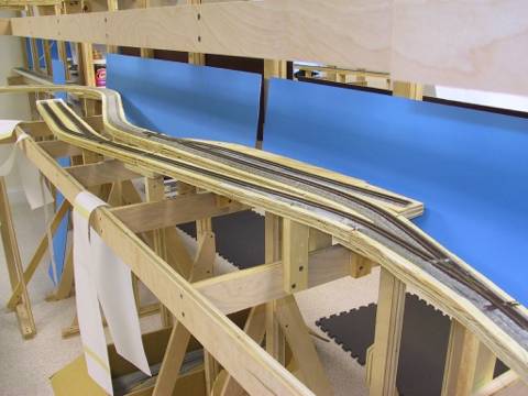
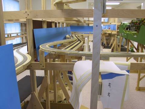
View of the horseshoe curve at the north end of Laurel showing the
current end of subroadbed just south of Shenandoah Junction, Va.
|
Another view of the curve between Laurel and Shenandoah Junction.
|
This view shows the future site of Shenandoah Junction, Va. where NS
trains from the CR&E Division will enter CSXT trackage rights.
|
A view of Laurel looking northward from behind the future backdrop.
|
Another view of Laurel showing the connection to the New Castle
peninsula.
|
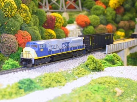
CSXT SD80MAC 801 crossing Craig Creek just south of Laurel on a work
train testing newly repaired track.
|
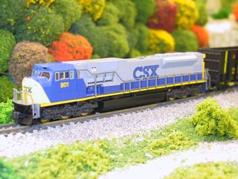
Another view of the 801 at Craig Creek.
|
This page was last updated on
01/01/11.